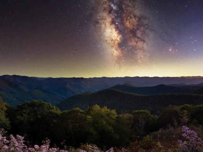
The mountains of western North Carolina hold a secret that urban dwellers rarely encounter: darkness. True darkness, the kind that existed before electric lights carved up the night. Drive three hours west from Charlotte, past the last strip mall and gas station, and you’ll find yourself in a place where the Milky Way stretches across the sky like spilled sugar.
Read MoreOutdoor Activities
Wilderness Fishing in Western North Carolina: Traditional Techniques for Long-Term Food Security
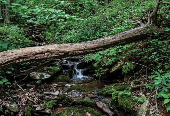
Western North Carolina’s mountain streams have sustained traditional fishing practices for thousands of years. The Cherokee developed sophisticated methods using handmade gear, natural baits, and deep ecological knowledge that modern practitioners can learn today. These time-tested techniques work consistently for long-term food security, from crafting hooks from bone and thorns to reading water like ancient texts. Brook trout, rainbow trout, and smallmouth bass respond to seasonal patterns that wilderness anglers can exploit with patient observation and traditional skills.
Read MoreMountain Biking Brevard NC: Mile of Trails in Pisgah and DuPont Forest
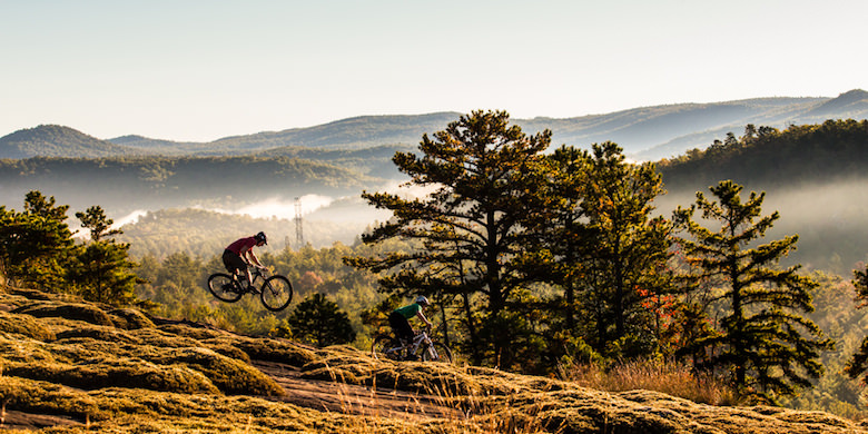
600+ Trails, World-Class Pisgah & DuPont Riding, and Everything You Need for the Ultimate North Carolina Mountain Biking Adventure Brevard, North Carolina stands as the “Cycling Capital of the South,” offering over 600 trails across 400+ miles of world-class singletrack within a 30-minute radius. This Western North Carolina mountain town delivers an unparalleled combination of […]
Read MoreHanging Loose: A Field Test of ENO’s Most Popular Hammocks
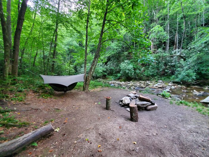
We tested ENO’s DoubleNest, SingleNest, and TravelNest hammocks across trails, campsites, and music festivals in Western North Carolina. Here’s how each one holds up in the real world.
Read MoreThe Mushroom That Looks Like a Brain and Tastes Like Crab: Foraging Lion’s Mane in Western North Carolina
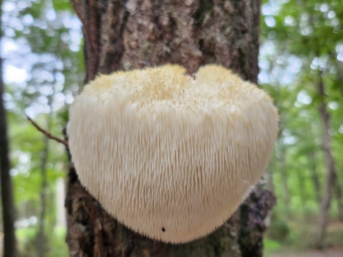
Lion’s mane mushrooms appear in North Carolina’s hardwood forests from late summer through fall. This guide covers where to find them, how to harvest them legally, and how to cook them once you do.
Read MoreSolo Backpacking in Western NC: Trails, Gear, and Safety for First-Timers

Thinking about going on your first solo backpacking trip? This guide breaks down everything you need to know from choosing beginner-friendly trails in Western North Carolina to essential gear, safety tips, and mental prep. Whether you’re craving solitude, challenge, or a fresh start, solo backpacking offers a unique chance to reconnect with yourself and the natural world.
Read MoreSkinny Dip Falls: Washed Away But Not Forgotten
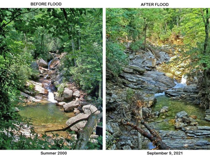
Skinny Dip Falls once offered clear pools, a short hike, and a sense of peace near milepost 417 on the Blue Ridge Parkway. After the 2021 flood from Tropical Storm Fred, the falls were torn apart but the memories remain.
Read MoreCamp Chef Deluxe Outdoor Camp Oven

First Impressions and Setup I set the Camp Chef Deluxe Outdoor Camp Oven on the picnic table and smiled at its polished steel shell. It weighed about 32 pounds but felt solid when I lifted it with the padded side handles and slipped it into its carry bag. The bag made transport easy and protected […]
Read More