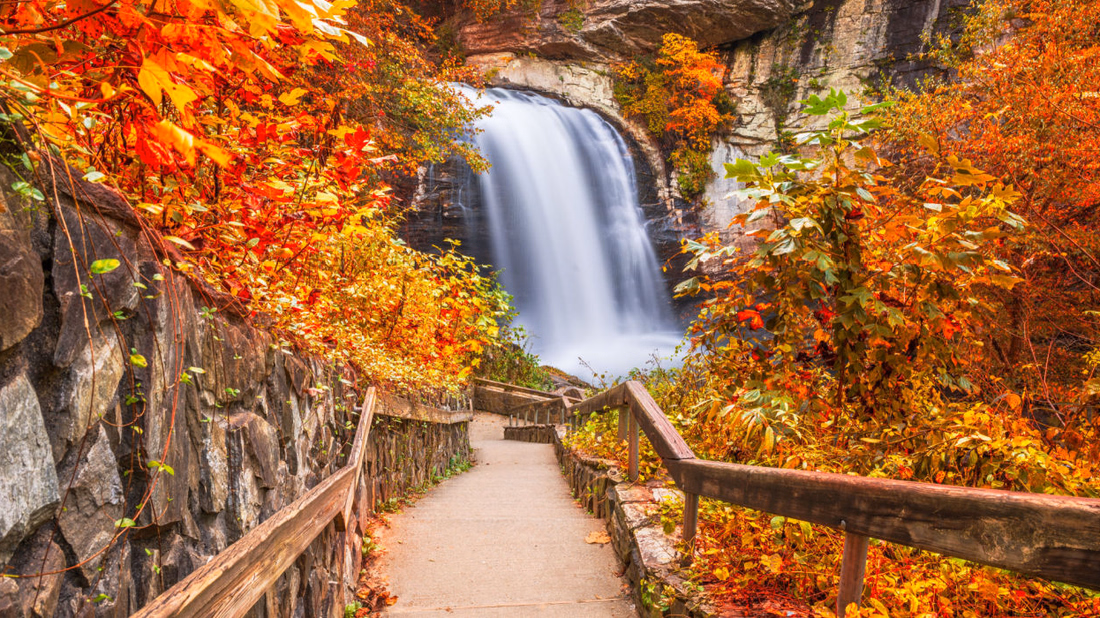
Western North Carolina offers an outdoor enthusiast’s dream: hundreds of cascading waterfalls paired with spectacular camping opportunities. Transylvania County alone, aptly nicknamed the “Land of Waterfalls,” boasts over 250 waterfalls, making it a must-visit destination for nature photographers and adventure seekers.
Read MorePisgah National Forest
Leaf Season in Western North Carolina
The Long Autumn Western North Carolina does not rush into autumn. The change arrives in stages, beginning high in late September and rolling slowly into the valleys by early November. The length of this descent is nearly six weeks long and is what makes the region rare. Most places offer a brief two-week window of […]
Read MoreWNC Backpacking Guide: Great Smoky Mountains, Pisgah National Forest & Blue Ridge Parkway Routes

Western North Carolina’s premier backpacking destinations, from the iconic Great Smoky Mountains National Park with its 100+ backcountry campsites to the challenging Art Loeb Trail through Pisgah National Forest. This comprehensive guide covers permit requirements, seasonal considerations, safety protocols, and detailed route descriptions for multi-day adventures across the region’s most spectacular wilderness areas.
Read MoreMountain Biking Brevard NC: Mile of Trails in Pisgah and DuPont Forest
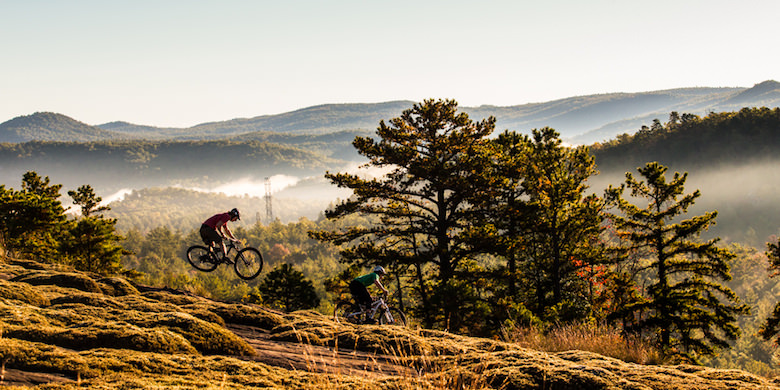
600+ Trails, World-Class Pisgah & DuPont Riding, and Everything You Need for the Ultimate North Carolina Mountain Biking Adventure Brevard, North Carolina stands as the “Cycling Capital of the South,” offering over 600 trails across 400+ miles of world-class singletrack within a 30-minute radius. This Western North Carolina mountain town delivers an unparalleled combination of […]
Read More7 Best Swimming Holes Near Asheville NC With Deep Mountain Pools
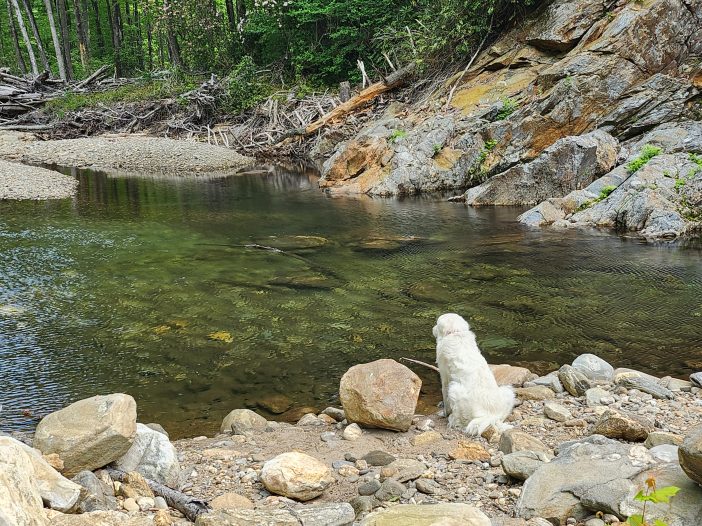
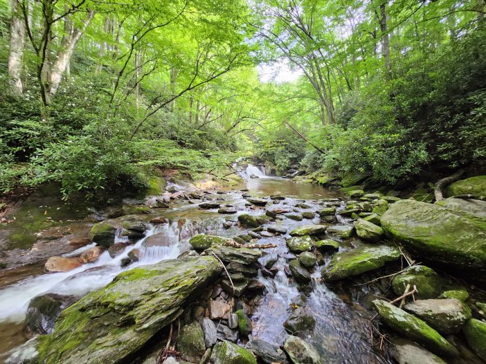
Summer in the North Carolina mountains gets hot fast. If you’re near Asheville and want a cold swim in clear water, these deep mountain pools are some of the best around. Most are under two hours from town and offer easy access, short hikes, or both. Skinny Dip Falls was once the go-to, but storm damage shut it down. These spots fill that gap and then some.
Read MoreFishing the Forks: Trout Streams of the East and West Fork Pigeon River, NC
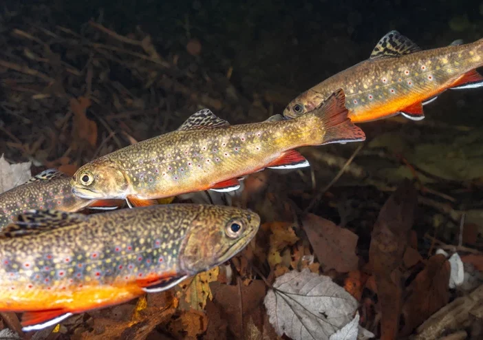
The Pigeon River in Western North Carolina is a favorite for trout anglers looking for clear mountain water, wild fish, and quiet stretches of stream. This guide covers where to go, what to bring, and how to make the most of your trip from fishing tips to nearby camping spots. Whether you’re fly fishing in the backcountry or casting spinners closer to the road, there’s something here for every kind of trout fisherman.
Read MoreSkinny Dip Falls: Washed Away But Not Forgotten
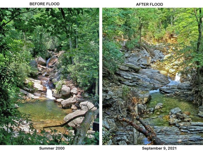
Skinny Dip Falls once offered clear pools, a short hike, and a sense of peace near milepost 417 on the Blue Ridge Parkway. After the 2021 flood from Tropical Storm Fred, the falls were torn apart but the memories remain.
Read MoreTranquil Waters: Exploring the Best Natural Swimming Holes in North Carolina
Dive into the natural beauty of North Carolina with our detailed guide on the top ten natural swimming holes in the state. From the verdant Pisgah National Forest to the tranquil waters of White Lake, we take you on a journey through these aquatic gems, providing key information on location, hazards, costs, and access. Embrace the spirit of adventure and immerse yourself in the untamed splendor of the Tar Heel State.
Read MoreChasing the Blue Ghosts: Discovering Fireflies in Western North Carolina

These captivating creatures, scientifically known as Phausis reticulata, bring an enchanting luminescence to the forests of Western North Carolina. Distinguished from other firefly species, the male Blue Ghost Fireflies emit a unique and sustained blue glow, hovering close to the forest floor during mating season in search of a mate.
Read More